Wildfire threat: Southwest blazes worsen across Utah and Nevada
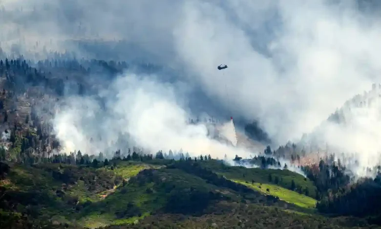
Table of Contents
Wildfire threat has reached a historic boiling point across the American Southwest, with extremely critical weather conditions threatening to rapidly expand several massive uncontained blazes. Over the last 48 hours, a perfect storm of environmental hazards has converged upon Utah, Nevada, and New Mexico. The National Weather Service (NWS) has issued its most dire warnings, designating the threat across the Great Basin and Four Corners regions as an “extremely critical risk”—the highest tier in the agency’s warning hierarchy. This warning coincides with a series of rare, “particularly dangerous situation” red flag warnings, emphasizing that the current scenario represents a grave, life-threatening emergency for dozens of mountain and desert communities.
At the epicenter of this crisis is Utah, which has recently declared a state of emergency. Fire crews across the region are battling several expansive fires that have already consumed hundreds of thousands of acres of parched vegetation. Evacuation orders are actively in effect for multiple jurisdictions, and wildland firefighters are facing unprecedented tactical challenges due to single-digit relative humidity, volatile winds, and a terrain rendered highly combustible by years of prolonged drought. According to the National Interagency Fire Center (NIFC), these combined factors have pushed regional preparedness levels to PL4, indicating that resource mobilization is at near-capacity.
Wildfire :The Meteorological Catalyst: Extremely Critical Fire Weather
The explosive growth of the wildfires currently plaguing the Southwest can be traced directly to an extraordinary atmospheric setup. High pressure locked over the desert interior has combined with a powerful weather system tracking to the north, creating a steep pressure gradient across the Great Basin and the Colorado Plateau. This pressure differential has generated sustained, powerful southwest winds that are sweeping across arid valleys and rushing through steep mountain canyons, providing a continuous supply of oxygen to active fire perimeters.
Wildfire :The Role of Wind Dynamics and Single-Digit Humidity
The interaction between high winds and record-low humidity has created an environment where fires can spread at speeds that defy historical expectations. Throughout the weekend, wind gusts of 45 to 50 miles per hour have been clocked consistently across central and southern Utah, as well as portions of northern Nevada and western New Mexico. When winds of this magnitude collide with relative humidity levels dropping into the single digits—often between 5% and 9%—the moisture within fine fuels like grasses, sagebrush, and forest litter is completely evaporated. This leaves the regional landscape primed for near-instantaneous ignition upon contact with any spark or ember.
Wildfire :Dry Thunderstorms and Lightning Ignition
Compounding the danger of these fierce wind dynamics is the sudden intrusion of monsoonal moisture high in the atmosphere, which has sparked widespread dry thunderstorms. These storms are characterized by frequent, intense cloud-to-ground lightning but offer little to no measurable precipitation at the surface, as any falling rain evaporates in the dry air column before reaching the parched earth. Lightning strikes from these storms have already ignited numerous new blazes and ‘lightning holdovers’—fires that smolder deep within tree roots or organic ground cover for days before suddenly exploding into life under the influence of daytime heating and wind. Fire managers warn that a single dry thunderstorm cell can seed dozens of new ignitions across hundreds of square miles in a matter of minutes, completely overwhelming local initial-attack resources.
Wildfire :Utah’s Cottonwood Fire: The Largest Active Blaze in the Nation
Nowhere is the severity of this emergency more evident than in Beaver and Piute counties in central Utah, where the catastrophic Cottonwood Fire is currently raging. Originating on Monday, June 22, 2026, near the Cottonwood Campground in Beaver Canyon, this human-caused wildfire has grown at an exponential rate. Within its first 24 hours, the blaze leaped past 10,000 acres, and by Saturday morning, it had ballooned to an astonishing 92,254 acres—covering more than 144 square miles. It currently holds the grim distinction of being the largest active wildfire burning in the United States, and remains at 0% containment despite the heroic efforts of nearly 900 personnel.
Destruction at Eagle Point Resort and Beaver County Evacuations
The rapid progression of the Cottonwood Fire has left a path of severe property damage and forced the emergency evacuation of numerous mountain communities. The fire made a violent run up Beaver Canyon along State Route 153, directly impacting the Eagle Point ski resort. While courageous structural protection teams managed to save several primary lodges and key chairlift facilities through miraculous stands, the fire did inflict significant damage on several secondary structures and mountain condominiums. Mandatory Level 3 ‘Go’ evacuation orders remain firmly in place for Eagle Point Resort, Merchant Valley, HiLo Estates, and Arrowhead Summer Homes. Local authorities have established evacuation pathways directing residents to flee east toward the small town of Junction, while air quality in neighboring Marysvale has plummeted to hazardous, ‘unhealthy’ levels as thick plumes of smoke block out the sun and rain ash down on local neighborhoods.
The Iron and Cherry Fires: Juab and Tooele Counties on High Alert
While the Cottonwood Fire dominates national headlines, northern and western Utah are grappling with their own severe fire complexes. In Juab and Tooele counties, the Iron Fire has consumed approximately 40,864 acres, forcing crews to wage a defensive battle to protect the historic mining town of Eureka and the surrounding communities of Elberta and Goshen. Fortunately, firefighters have managed to establish a 38% containment line around portions of the Iron Fire, though the perimeter remains vulnerable to shifting winds.
Simultaneously, the nearby Cherry Fire—which formed after the rapid merger of the Maple Peak Fire and the original Cherry Fire near Weiss Highway—has scorched 30,766 acres and remains entirely uncontained at 0%. Driven by extreme wind events that prevented firefighters from holding established road systems, the Juab County Sheriff’s Office issued emergency evacuation orders for Eureka, Mammoth, and Silver City. The rapid consolidation of these fires has forced regional managers to combine command structures, placing both the Iron and Cherry fires under the unified direction of Great Basin Complex Management Team 3 in an effort to maximize the efficiency of their limited resources.
Southwest Regional Threats: Nevada and New Mexico Battle Rising Risk
The fire crisis is not confined within Utah’s borders; rather, the entire Southwest is currently locked in a defensive battle against escalating blazes. In Nevada, the Great Basin’s dry, grass-dominated valleys are experiencing a rapid surge in wildfire activity. Gusty winds are driving fast-moving grass fires that threaten rural ranching communities and critical infrastructure, including power transmission lines that feed major metropolitan areas. State agencies in Nevada have positioned initial-attack crews along high-risk corridors to prevent new ignitions from growing into uncontrollable conflagrations.
To the east, in New Mexico, the situation is equally tense. The state’s heavily forested mountain ranges are parched after a winter of below-average snowpack and weeks of early-summer heat. Dry thunderstorms rolling across the Four Corners region have triggered multiple new starts in New Mexico’s northern and western districts. Fire managers there are working closely with federal partners to monitor remote wilderness areas, where rugged terrain makes direct ground attack nearly impossible. With the NWS extending its critical fire weather warnings across the entire Four Corners zone, communities from Farmington to Gallup remain on high alert, preparing emergency kits and reviewing evacuation routes in anticipation of further fire outbreaks.
Statewide Emergency Declarations and Fireworks Restrictions
Recognizing the unprecedented threat posed by these simultaneous blazes, Utah Governor Spencer Cox has officially declared a statewide State of Emergency. This critical declaration unlocks additional state funding, mobilizes National Guard resources, and allows for streamlined inter-agency cooperation. Crucially, the emergency order imposes strict, immediate restrictions on the use of personal fireworks and open campfires across sensitive public and private lands, particularly with the July Fourth holiday weekend rapidly approaching. State Forester Jamie Barnes highlighted that with fire crews already stretched to their absolute limits, the state cannot afford a single spark from preventable human activity, warning that violators will face severe legal and financial penalties.
Firefighting Safety and Resource Strain: Moving to PL4
The physical and operational demands on the personnel fighting these blazes are immense. Because the Cottonwood and Cherry fires are burning through exceptionally steep, rugged mountain terrain, getting heavy equipment like bulldozers and fire engines directly to the active flanks is slow, dangerous work. During periods of peak winds, aviation assets—including heavy air tankers and water-dropping helicopters—have been repeatedly grounded due to turbulent air currents and zero-visibility smoke conditions. This forces ground crews to engage in grueling, hand-to-line construction under extreme thermal stress.
The escalation of the Southwest’s wildfire crisis has pushed the Great Basin geographic area to Preparedness Level 4 (PL4). This designation reflects a high level of wildfire activity, with a significant portion of regional firefighting resources committed to active incidents. With dozens of uncontained fires burning simultaneously across the United States—from Alaska to the Southwest—the national pool of specialized crews, such as Type 1 Interagency Hotshot Crews, is experiencing severe strain. Emergency managers are urging the public to practice extreme vigilance, emphasizing that prevention is currently the most effective tool available to protect lives and preserve communities during this historic crisis.
Wildfire Activity Comparison Table
The following table provides a comprehensive summary of the major active wildfires currently burning across the region as of late June 2026:
| Fire Name | Location (County/State) | Acreage Burned | Containment Status | Primary Fuels & Threats |
|---|---|---|---|---|
| Cottonwood Fire | Beaver and Piute Counties, Utah | 92,254 acres | 0% contained | Dense mountain timber; threatening Eagle Point Resort and Merchant Valley. |
| Iron Fire | Juab and Tooele Counties, Utah | 40,864 acres | 38% contained | Grass, brush, and pinyon-juniper; threatening Eureka and Highway 6 corridor. |
| Cherry Fire | Juab and Tooele Counties, Utah | 30,766 acres | 0% contained | Sagebrush, grass, and dry timber; formed by merger of Maple Peak & Cherry fires. |
| Great Basin & Four Corners Starts | Nevada & New Mexico (Regional) | Varies (Active) | Varies by incident | Dry grass and high-altitude forest; driven by dry thunderstorms and lightning. |