Hurricane Forecasts: 5 Powerful Insights Into El Niño and Hurricane Risks
Hurricane forecasting has entered a complex phase as meteorological models confirm the development of a powerful El Niño pattern in the equatorial Pacific Ocean. This major climate driver is drastically altering atmospheric circulation, leading to a stark divergence between the Atlantic and Pacific hurricane basins. While Atlantic coastal residents might feel a sense of relief hearing about a projected below-average season, meteorologists at the National Oceanic and Atmospheric Administration (NOAA) warn against complacency. Historical data suggests that seasonal volumes do not correlate with localized destruction.
1. Introduction: A Tale of Two Basins
The global climate system is defined by its interconnectedness, where a shift in sea surface temperatures in one ocean can trigger dramatic weather anomalies thousands of miles away. The transition into a strong El Niño pattern represents one of the most significant planetary drivers of seasonal weather. In 2026, this atmospheric shift has created a dual-reality for tropical meteorology: a heavily suppressed Atlantic basin contrasted against an energized, highly active Pacific basin. For emergency managers and coastal residents, interpreting these dual realities requires moving beyond raw numbers and focusing on hyper-local risks.
2. Understanding the El Niño Phenomenon and Wind Shear
To understand the current tropical outlook, one must analyze the El Niño-Southern Oscillation (ENSO) cycle. El Niño is characterized by the warming of sea surface temperatures in the central and eastern equatorial Pacific. Under neutral conditions, trade winds blow from east to west across the Pacific, pushing warm water toward Asia. During El Niño, these trade winds weaken or even reverse, allowing warm water to slosh eastward toward the South American coast.
This massive reallocation of thermal energy disrupts global atmospheric circulation, specifically altering the Walker Circulation. As warm water pools in the eastern Pacific, it enhances convection and thunderstorm activity in that region. This upward movement of warm air alters the jet streams aloft, sending ripples across the troposphere that cross Central America and spill directly into the tropical Atlantic basin.
2.1 The Physics of Vertical Wind Shear
The primary mechanism by which El Niño suppresses Atlantic cyclogenesis is vertical wind shear. Vertical wind shear refers to the change in wind speed and direction with height in the atmosphere. For a tropical disturbance to organize, it requires a vertically aligned core. Warm, moist air must rise symmetrically around a central low-pressure area, releasing latent heat as it condenses to power the storm’s engine.
When upper-level westerly winds from the Pacific collide with low-level easterly trade winds in the Atlantic, they create an environment of high vertical wind shear. This shear literally tilts the developing storm system, separating the low-level circulation center from the upper-level convection. Without a cohesive vertical stack, the storm cannot efficiently utilize ocean heat, resulting in weaker systems that struggle to organize or quickly dissipate.
3. The Pacific Basin Paradox: High Activity and Warming Waters
While the Atlantic experiences hostile developmental conditions, the exact opposite occurs in the Pacific. The very same El Niño characteristics that generate destructive wind shear in the Atlantic create an atmospheric cradle in the eastern and central Pacific. Sea surface temperatures in these zones rise well above long-term averages, providing an abundance of thermal energy—the high-octane fuel required for rapid cyclogenesis.
Furthermore, the vertical wind shear over the Pacific Basin drops significantly during El Niño phases. With minimal shear to disrupt rising convective columns, tropical disturbances can quickly organize into major hurricanes. This active Pacific season presents elevated risks to Western Mexico, Baja California, Hawaii, and, occasionally, the southwestern United States, where moisture remnants can trigger catastrophic inland flooding.
4. Breaking Down the NOAA Atlantic Forecast Numbers
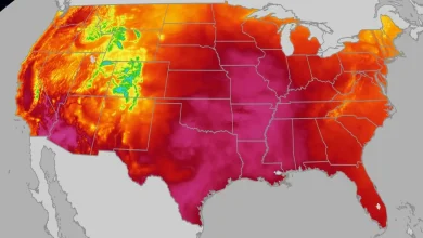
For the Atlantic basin, NOAA forecasters have released a below-average outlook, driven heavily by these persistent El Niño dynamics. The agency predicts a range of eight to 14 named tropical storms. Of those named systems, forecasters project that just three to six will reach hurricane strength, which requires sustained winds of at least 74 mph (119 km/h).
While these numbers are comforting compared to the hyper-active seasons of the early 2020s, they still represent a formidable amount of tropical energy. The baseline average for a typical Atlantic season is 14 named storms and seven hurricanes, meaning the 2026 forecast represents a tangible, but not absolute, reduction in activity. Importantly, these statistical ranges do not indicate where or if any of these storms will make landfall.
4.1 Differentiating Named Storms from Major Hurricanes
It is vital for the public to understand the classification threshold of tropical systems. A tropical depression becomes a named tropical storm when its maximum sustained winds reach 39 mph. At this stage, the storm receives a name from a rotating international list. Once sustained winds touch 74 mph, the system is classified as a Category 1 hurricane on the Saffir-Simpson scale.
Major hurricanes—defined as Category 3, 4, or 5 systems—possess sustained winds of 111 mph or higher. While El Niño reduces the overall likelihood of these monster storms forming in the Atlantic, it does not make their existence impossible. Under localized pockets of low shear and high ocean heat, a solitary storm can rapidly intensify into a major catastrophic event.
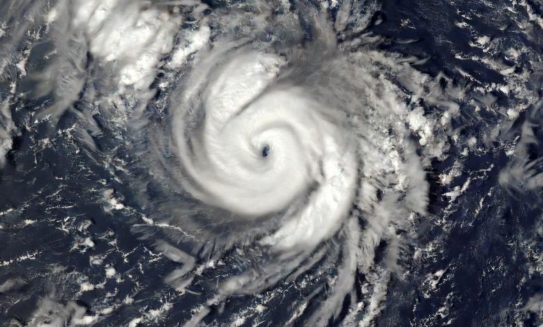
5. Historical Precedents: The Devastating Lesson of Hurricane Andrew (1992)
To contextualize the dangers of a quiet season, meteorologists frequently point to the historical precedent of 1992. That year, the Atlantic was experiencing a moderate-to-strong El Niño, and the seasonal forecast was similarly suppressed. Indeed, the overall season was quiet, producing only six named storms—well below typical averages. However, one of those six storms was Hurricane Andrew [1].
Andrew developed slowly in the mid-Atlantic, initially struggling against wind shear. As it neared the Bahamas and Florida, it entered a localized pocket of favorable atmospheric conditions and underwent rapid intensification. Andrew slammed into South Florida as a Category 5 hurricane, obliterating entire communities, causing tens of billions of dollars in damage, and fundamentally reshaping building codes and emergency management practices across the nation [1].
5.1 The ‘It Only Takes One’ Forecasting Philosophy
“It just takes one,” Ken Graham, director of the National Weather Service, emphasized during a press briefing discussing the seasonal predictions. This simple adage serves as the cornerstone of modern disaster preparedness. From a statistical standpoint, a below-average season is an academic observation; from a survival and safety standpoint, the season is defined entirely by whether a storm strikes your community.
A quiet season with one major landfall is exponentially more destructive than an active season where twenty storms remain over the open ocean, harmlessly spinning out their energy. Therefore, seasonal forecasts should never dictate individual readiness levels. Preparing for a below-average season requires the same rigorous planning as preparing for an record-breaking active year.
6. Comparative Basin Analysis: Atlantic vs. Pacific
To illustrate the stark divergence between the Atlantic and Pacific basins during this El Niño phase, the following comparison highlights the primary meteorological parameters at play.
| Atmospheric Metric | Atlantic Basin (El Niño Impact) | Pacific Basin (El Niño Impact) |
|---|---|---|
| Vertical Wind Shear | High / Strong (Suppresses storm vertical alignment) | Low / Weak (Allows rapid storm organization) |
| Sea Surface Temperatures (SST) | Variable (Often offset by shear forces) | Significantly above average (High thermal fuel) |
| Storm Volume Outlook | Below-average (8 to 14 named storms predicted) | Above-average (Highly active cyclogenesis) |
| Landfall Threat Profile | Low volume, but high localized vulnerability | High danger for Western Mexico & Pacific islands |
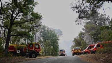
7. Coastal Preparedness, Infrastructure, and Policy Response
The complexity of contemporary forecasting is further compound by rapid coastal urbanization. Millions of people have moved to vulnerable coastlines along the U.S. East Coast and the Gulf of Mexico since the historic 1992 season. This shift means that even a minor Category 1 or 2 storm can cause multi-billion-dollar losses due to storm surge, inland flooding, and infrastructure failures.
Furthermore, local states and municipalities face significant challenges in managing resources. Tracking ecological and meteorological changes during high-intensity seasons requires robust data networks. This is comparable to other complex, multi-agency challenges, such as navigating critical challenges in administrative data access, where global and local public agencies struggle to bridge information sharing gaps during emergencies.
The ecological impacts of major storms also cannot be ignored. Powerful landfalling storms permanently alter fragile barrier islands, disrupt marine estuaries, and destroy critical animal habitats. These environmental shocks require active intervention and complex planning, reminiscent of long-term state-directed wildlife conservation and management policies that try to balance human survival with environmental stewardship in volatile landscapes.
8. Economic Implications and National Disaster Relief Systems
The financial ramifications of a single catastrophic landfall extend far beyond local property damage. When a major hurricane breaches heavily populated metropolitan areas, the resulting damage can disrupt global supply chains, severely impact energy production in the Gulf of Mexico, and destabilize private insurance markets. The economic strain placed on federal reserves and catastrophe funds during such crises is immense.
When the Federal Emergency Management Agency (FEMA) and the National Flood Insurance Program (NFIP) face massive, unexpected liabilities, the federal government is forced to intervene. This economic pattern mirrors systemic vulnerabilities seen across other areas of government spending, where the scale of emergency operations and federal risk frameworks resembling financial interventions become necessary to stabilize unstable sectors. A quiet season that produces one massive hit can trigger identical fiscal shockwaves to a multi-storm year.
Ultimately, seasonal projections must be viewed as atmospheric guides rather than personal shields. While El Niño alters the thermodynamic landscape in our favor in the Atlantic, the danger remains real. Proper evacuation plans, secure building envelopes, and comprehensive insurance coverage are the only reliable defenses against a system that, as history warns, only needs to strike once to redefine a generation.